
This was a trip that I had been dreaming about ever since I left home in Plymouth and went off to college in Boston. How cool would it be to gather up a few friends, hop in the kayaks, and paddle home to Plymouth to wrap up the school year? It would be EPIC and it was!
I finally got around to the Boston to Plymouth trip after the spring 2010 semester. Alex and Josh, two instructor friends from my days at Coastal Kayak Educators (CKE) made the trip up to Cambridge to meet me at my grad school apartment. Our schedules had finally aligned and the weather looked great for the next few days. That night we feasted on pasta, meatballs, garlic bread and salad to fuel up for the journey ahead. After dinner, we plotted the route on our nautical charts. The 48 mile route started at Presidents Landing on the Mystic River in Everett and would take us through Boston Harbor and along the South Shore to the CKE docks in Plymouth Harbor. Our goal was to complete the journey in one long day but we had contingency gear and food in the case that we needed a night out along the way. We checked and bagged our gear and went to sleep in preparation for an early morning launch.
The next morning, we hitched a ride to the launch site with my brother. It was barely 6:30am when we shoved off from Presidents Landing. The sky was clear, the wind was light, and the temperature was cool enough to form morning dew on our decks. We hadn’t made it very far when we encountered our first obstacle: The Mystic River Dam. I was not aware that the operators would open the locks for kayaks (they will if you hail them via radio or whistle) so we decided to portage the dam on its eastern bank. The rocks were slimy and slippery and the water was disgusting. The scene reminded us of the Departed; we half expected to find body parts amongst the garbage and debris held back by the dam. Josh and I were the first to climb the rocks. All of a sudden Josh slipped and slid up to his knees into the water. Thankfully he was physically ok but he may still be mentally distraught after touching that water!
Our portage of the Mystic River Dam was quite a process but after about 45 minutes we were back in our boats and on our way into Boston Harbor. We found the tide to be swift and outgoing. This part of the Mystic River was lined with large container ships full of scrap metal, coal, and Subaru cars. We were minuscule in comparison to these monsters and hoped that we would be visible to their operators in the case that they came to life. Then, on river right, we passed the Constellation Tugboat docks where our kayaking friend Ben was preparing for work. Charlestown Harbor was populated by a group of early morning sailors who elegantly tacked against the gentle breeze. The backdrop was the Boston waterfront; the buildings glistened with the rising sun. It was my first time paddling in Boston’s Inner Harbor and it was picture perfect!
The tide grew stronger and helped to pull us out of the Inner Harbor toward Presidents Roads and the Boston Harbor Islands. We made sure to stay well out of this busy channel by staying the south-west. Jetliners buzzed overhead on their decent into Logan. They were so low it felt like you could reach up pick them out of the sky. Spectacle Island passed to the right and we set course toward Long Island Head Light. Rounding the eastern tip of Long Island we entered our first tricky piece of water. “The Narrows” is a notorious channel between Long Island Head and Nixes Mate that it known for its strong rip currents. We set our course to the south east for a half mile to avoid the worst of the rip before crossing the channel and landing on Georges Island.
Georges Island offered a relaxing reprise and a chance to re-fuel. We hustled up the beach and snatched a picnic table before the tourists from the ferry could stake their claim. It was only about 10:00am as we dove into our dry bag full of peanut butter sandwiches and oatmeal pies. We had put some distance between us and the hustle and bustle of the Inner Harbor as the skyline sat about 6 miles away on the horizon. After a short break we launched and looped around Georges Island to the North toward Lovell’s Island. There stood our second challenge: a 2.5 mile open water crossing across the mouth of Nantasket Roads.
The tide had eased slightly but it was still running pretty good and the seas were bigger at about 2-3 feet. We struck out towards Point Allerton and oh-what-a-ride it was! Ground swell was coming in off of the Atlantic and met the outgoing current of Nantasket Roads to build the seas further to 4-6ft. Various cross currents further confused this cauldron as we pushed forward. Josh led the way and he would frequently disappear in the tough only to reappear high on the next crest. It was exhilarating and much like surfing a rollercoaster! After only about a half hour we found ourselves passing Point Allerton. The currents of Nantasket Roads had pushed us about a half mile out to sea but we were fine with that as it kept us well away from the crashing surf at the point. We were past the biggest hurdle and found ourselves safely on the “South Shore” with only 39 miles to go!
A Northeast wind had picked up and began to push us South along Nantasket Beach. We closed the gap from shore to a quarter mile and marked Gunrock Beach as our next stop. There we found some attractive, bikini-clad sunbathers on a pleasant, sandy beach. They didn’t seem to take much notice of us and were probably turned off by our salt-covered gear and gnarled hair. We packed down a few more oatmeal pies, did our business behind some nearby rocks, and shoved off at just past noon-thirty. I slipped during my launch and landed with my butt in the water…the sunbathers had distracted me.
The third leg of our journey would take us through the Cohasset rock gardens to Minot. It was my first time in the gardens and I relished what we found. Hundreds of small islands, house-sized rocks, and ledges dotted the coast. We couldn’t resist the temptation to surf and play amongst the rocks as we meandered to the south. The tide was finally low and our progress began to slow considerably. Our boats began to feel cramped and little nuances drove us mad. Josh complained of a small piece of epoxy that was irritating his knee, Alex started to turn red with a sunburn, and my heels were beginning to fall sleep but we pushed on another six miles toward Minot.
We each made spectacular landings in 3foot surf at Minot. It was 3:00pm and we had a long way to go. Josh and I were still feeling it and felt that we could push through to Plymouth and make it by midnight. The look on Alex told a totally different story. He was as red as his kayak and felt hot to the touch. We feared that heat exhaustion or worse would catch up with him within a few hours and we scrapped any plans to finish in one day. We huddled in the shade of the rocks and assessed our situation. The best option seemed to be to continue on past Scituate Harbor and try to find a good place to land at the Spit. This would offer us a decent and secluded camping spot, prevent the need for navigating the dangerous currents at the mouth of the North River in our weakened state, and put us about 18 miles from home. The last part was critical because Josh had neglected to tell us that he was expected to be at his girlfriend’s house for her senior Prom by 2:00pm the next day. This earned him the nickname “Prom King” for the rest of the trip.
The fourth leg of the trip was just plain brutal. All of the current and wind that had helped us along to Minot was now gone and we had to earn every bit of forward porgress. Alex was also beginning to deteriorate and become more sluggish as the sunburn and heat exhaustion caught up with him. We rounded Scituate Light where we found a young couple making out at the end of the Jetty. They giggled and waved at us as we passed by. Somehow we made it to the Spit in descent time. Our survey of the coastline yielded very little in the way of a good landing spot as the surf was up around 4-5ft. We were about a half mile off shore with an incoming tide. It would be tricky to attempt a landing and we decided to continue on (while remaining offshore) past the mouth of the North River to Hummarock where we hoped the surf would be a bit more tame for our landing.
The offshore trick worked and we made it past the dangerous currents at the mouth of the North River without incident. However, the surf in Hummarock was only a little less intense at 3-4ft and the beach was much rockier. We had no choice at this point as Alex looked visibly sick and needed to get off the water. We picked a spot on the beach and Josh made the first attempt. He mistimed the breaking wave and crashed onto the beach, cutting his knee on the rocks as he rolled out of is kayak. Alex and I couldn’t have timed it more perfectly as we coasted into the beach on the back of a nice, clean wave. We scrambled to clear out of the surf zone and helped Josh move his boat up the beach.
There was no hiding how beat we were at this point. It was now 6:30pm and we had completed 33 miles with over 10 hours logged on the water. Alex grabbed his sleeping pad and passed out on the middle of the beach for a quick nap. Josh and I moved the boats up to the seawall for the night and munched down a few more PB&J sandwiches. We had packed nearly two dozen sandwiches for the trip and were down to about six. They barely put a dent in our hunger so we decided that we would take a hike into town for some real dinner when Alex woke up from his nap. A few locals took interest in us as they walked down the beach. We were a bit defensive because we thought that they wouldn’t like the idea of us spending the night on their beach. However, they were impressed by how far we had come and didn’t provide us much grief given our situation.
Hummarock is a small, beachside community nestled between Scituate and Marshfield. The rocky beach was once lined by quaint, summer shacks but these were being replaced by expensive, vacation homes. We left our kayaks on the beach as we set out to explore town and find some grub. The Bridgewaye Restaurant off of Sea Street seemed quite inviting. Their menu features an assortment of seafood and American fare and we ate to our hearts content. Arguably we would have been under-dressed for a McDonalds but they served us just the same. The food coma was fast approaching so we hustled back to the boats, rolled out our sleeping pads and tucked in for the night on top of the concrete sea wall. I had never slept so well on such a hard surface in my entire life!
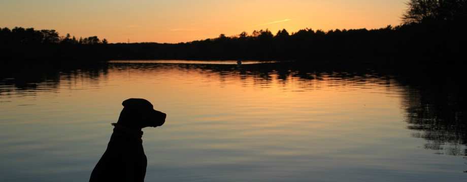
The next morning delivered a picture-perfect sunrise over a glass-like sea. It was 5:30am and we decided not to waste any time, especially considering that our Prom King had a big date in a few hours. Paddling between Hummarock and Brant Rock was a dream: flat-calm and cool. We made great time as we shot the gap at Brant Rock and turned SW toward Duxbury Beach. As the sun climbed higher a light NE wind began to pick up and push us home. There was no surf to speak of at Duxbury Beach and the tide was just past high. It was a no-brainer as we unanimously decided to forgo the extra six miles it would take to paddle around the Gurnet. We would portage Duxbury Beach near the Powder Point Bridge and take a direct line across Duxbury Bay back to Plymouth Harbor.
The portage was smooth and uneventful, except for Josh’s antics. He had spotted something red lying on the sand and went over to investigate as Alex and I continued to move the gear across the beach. It turned out to be a pair of lace panties and Josh wasted no time in finding a stick so he could fling them at us as he chased us down the beach. Classic Josh!
There was roughly six miles from the Powder Point Bridge to our final destination in Plymouth Harbor. This sixth and final leg would be the perfect ending to this epic trip! That light NE wind had built up to about 10mph during the time it took us to portage and was perfectly aligned with our course. That coupled with an outgoing tide drove us across Duxbury Bay like a rocket ship. We surfed 2-3ft, wind-blown wave-trains most of the way. It was so much fun that we could have spent the whole day playing out in the Cow Yard but we were due back in port.
It was just before 9:30am when we coasted past the Mayflower and Plymouth Rock. Those last six miles had taken only an hour. Tourists took pictures of us from their vantages on the waterfront. If only they knew how far we had come and the stories that we had to tell about our adventure! We paddled up the familiar mouth of Town Brook into Brewer’s Marina and the CKE docks. There we took the boats out of the water, posed for a final photo and embraced. We were proud and exhausted and covered in enough sea salt to fill a salt shaker! It was an amazing homecoming and a trip that could not have been more perfect or fulfilling. It was and will always be one for the books!
Trip Details:
Launch: Presidents Landing, Everett, MA
Landing: Brewers Marina, Plymouth, MA
Highlights: Paddling through Boston Harbor, Big Water along Nantasket Roads, Cohasset Rock Gardens, Night on the Beach at Hummarock, Sunrise Paddle in Brant Rock, Downwind Run on Duxbury Bay.
Duration: 16 hours on the water over two days (12 hours on Day 1, 4 hours on Day 2)
Distance: ~48 miles (33miles on Day 1, 15 miles on Day 2)
Good Eats: Bridgewaye Inn and Restaurant on Sea Street in Hummarock, MA
Kayak Dave Rating: 5 out of 5 paddles. Can’t wait to do this again…this time in one day!
Notes:
Kayak Dave does not recommend this trip for anyone but experienced sea kayakers who are very fit, well equipped, and capable of handling a wide array of sea conditions and emergency situations. Numerous sections of this trip (e.g. The Narrows, Nantasket Roads, Minot Ledge and the mouth of the North River) can pose significant risks to small craft depending on conditions. Also, we do not endorse non-permitted camping on public or private beaches as it is illegal to do so.
Map:

Pictures:

Alex and Josh prepare to launch at Presidents Landing

Boston Inner Harbor

The Crew takes a break on Georges Island

Our campsite on the beach at Hummarock

Alex is as red as a boiled lobster!

Sunrise at Hummarock

Classic Josh!

The Crew at the CKE docks in Plymouth...What a trip!
4 Responses to Trip Report: Boston-to-Plymouth Epic